The Kaimanawas – Thunderbolt circuit (Dec 26-28, 2016)

This year we carried on our Christmas tradition of tramping, tramping, tramping as much as possible in New Zealand (even though these days we reside in Australia).  We flew into NZ on Dec 23 and had a couple of days with Dylan’s family on the north island.  Then, on boxing day we drove and picked up our mate (another kiwi who lives in Australia with us, but was also visiting family over Christmas) and drove south to start our first trip.  Due to the weather patterns this year (a La Nina weather pattern in NZ), there was a lot of re-shuffling of our plans.  We ended up doing our trips backwards from our original itinerary (the best laid plans in the world are all for naught if the weather doesn’t cooperate).

The Kaimanawas is an area that we have wanted to explore for some time.  Although there isn’t the same quantity of tramping in the North Island as the South Island of New Zealand, there are still a number of areas that we have wanted to explore, and the Kaimanawas was one of these.  Dylan picked out the most difficult route, a three day circuit up the Thunderbolt track, across the tops and down to the Waipakihi hut.

This trip was also my chance to try out a new lens for my camera, which I conned Dylan into letting me buy right before our trip, and a Dylan got to try out his brand new Osprey pack which I was somehow conned into letting him buy!

OLYMPUS DIGITAL CAMERA

New pack!

Overall the trip was good.  After living in Australia for 8 months, I have a renewed appreciation for how lush NZ bush is and was able to see it through new eyes!

OLYMPUS DIGITAL CAMERA

We did end up doing quite a bit more bush bashing than anticipated, as the track isn’t quite a complete loop and you will either need to road bash a few kilometers at the start or end of the track, or do as we did, and try to follow some old power lines from the substation (I do not recommend).  We then climbed up to Urchin, down to Waipakihi stream and intended to follow the thunderbolt track.

Well, just as an FYI, this track is not correctly located on the NZ topomap.  We followed the track as mapped, but just bushbashed our way up the hill for about 450m.  We did find these lovely old permalac markers to taunt us.

OLYMPUS DIGITAL CAMERA

Infamous track marker

Eventually, we did find the track, about 150m lower than we were.  At which point we were totally exhausted (both myself and our mate were getting over some seriously nasty bugs, and our mate’s knee was absolutely done for) and nearly at the bushline.  We popped up above the bush and camped for the night.

Day 2 resulted in some pretty incredible near white out fog conditions.

OLYMPUS DIGITAL CAMERA

Mist provides such atmosphere and views are over-rated.

OLYMPUS DIGITAL CAMERA

Actually no, no they are not.

We ambled (or, in our mate, Scott’s case) shambled across the tops.  There was a bit of a route in some sections, and Dylan did an amazing job navigating us across the range.

At the end of the day, the weather had really cleared and we were treated to a most welcome swim in a perfect swimming hole just before reaching Waipakihi hut and becoming re-united with the official track.

OLYMPUS DIGITAL CAMERA

Swimming hole

Day three dawned absolutely amazing – and we knew it would be our shortest day back to the car!  We had a pre-tramp swim (as you do).  And after a short climb up to the Umukarikari track, we were rewarded with some absolutely stunning views of Mt. Ruapehu.

OLYMPUS DIGITAL CAMERA

Mt. Ruapehu

It was an absolutely perfect day with crystal clear views of Ruapehu and Ngauruhoe.  It’s views like this that make us get out of bed, put on a pack and start walking.  Simply stunning and there is no place I’d rather be.

OLYMPUS DIGITAL CAMERA

This is what we live for

Writing this post makes me realize how much I miss NZ, the landscape, the mountains.  I don’t know that there is any place I’d rather be.

And if you’re wondering how Scott’s knee fared after 3 days, well it’s safe to say he was done for after this trip.  But Dylan and I managed to squeeze a few more days tramping in despite the odds being against us (it was an eventful holiday).

Happy tramping!


How to plan a tramping wedding

Hey readers.  So this is a very long overdue post.  Dylan and I actually tied the knot in December last year!  Yes  – it’s been over 6 months since we had our wedding, and in the time in between we’ve done a ton of tramping, moved house 3 times, had 4 weeks in the USA (another wedding celebration), moved overseas, I started a new job.  It’s actually been nuts.  So now that we’ve been in Australia for 2 months and have finally just gotten connected to the internet, I actually have time to sit down and tell you how to plan a hiking/tramping themed wedding.

We decided in May last year that we would get married in December (when Dylan graduated with his PhD, so his family only had to come for 1 visit).  I had been toying with the idea of having a tramping wedding as it is our obsession, but I wasn’t quite sure how to pull it off (e.g. spectacular scenery vs. ease of access for guests).  Sadly, a helicopter wedding was out of our budget, but we still wanted something spectacular.

In June, we decided to do a trip along the Livingstone range.  We had a fabulous day across the tops from Key Summit and realized that Key Summit would be the perfect spot for a wedding – only ~1 hour easy walk along the Routeburn track from the Divide – which is a mere 1 hour from Te Anau.  This was feasible.  Easy walk.  Spectacular Scenery.  All we needed was the weather to cooperate…

OLYMPUS DIGITAL CAMERA

Tarns along the Livingston range

OLYMPUS DIGITAL CAMERA

Key Summit – June 2015

In the meantime, I had to alert all of our guests of our crazy plan, as well as find a celebrant and photographer who were willing to get on board with a tramping themed wedding (and were sufficiently flexible considering we were very weather dependent).  Somehow I lucked out and managed to get the most perfect wedding celebrant – DOC worker and former Milford Track Guide, Christine Officer.  I lucked out again when the absolutely amazing photographer Jim Pollard agreed to shoot our wedding.

Fast forward to December…

The weekend before the wedding, Dylan and I decided to head up to Key Summit to scope out locations.  The weather was atrocious.  It was cloudy, rainy, freezing.  It was literally snowing.  Despite it only being a 2 hour walk, by the time we got back to the car, we could barely move our fingers.  We decided to drive farther up the Milford road to scope out additional and alternative locations, as well as possible photo locations – should everything go south on the day of the wedding (weatherwise).

OLYMPUS DIGITAL CAMERA

Scoping out wedding spots

OLYMPUS DIGITAL CAMERA

Lovely weather for a wedding

The week of the wedding was chaos with friends and family arriving from overseas.  To add to the ridiculousness of it all, on the Sunday and Monday before the wedding, Dylan and I took our respective Mothers & Sisters tramping to one of our favourite locations (Brewster hut) to give them a real tramping experience.  It was a pretty epic trip, and despite pushing everyone to their physical limits, they still had a good time.

OLYMPUS DIGITAL CAMERA

Pre-wedding family bonding tramp – success photo!

Upon returning from the tramp, Dylan and I were obsessively watching the forecast for the divide, and keeping our fingers crossed.  The day of our wedding (a Thursday, of all days!) dawned a little breezier than we’d hoped, but it was sunny enough.

We met up with all of our guests in the carpark of the Te Anau Community centre and made a convoy of vehicles driving out to the Divide.  As we got closer and closer to the Divide, the weather became misty, foggy and it started to rain (of course).

At the divide, we had a little pow-wow with our guests, celebrant and photographer and despite our guests being super keen to head up to Key Summit, instead we elected to drive 10 min down the road to a sunny spot…

And I’ll let Jim’s photos take it from here

So there you have it – our tramping wedding.  As per any tramp, the weather didn’t cooperate and it didn’t quite go to plan, but we had a great time anyways.  And of course, our photographer captured it perfectly!

Our Wilderness Wedding-364

A pure New Zealand wedding, with guests wearing tramping boots and all.

Happy tramping!

Cascade saddle/Lochnagar/Shotover saddle (Feb 6-11, 2016)

Hey Readers!  Sorry it’s been so long – Dylan and I have some very serious catching up to do – the backlog is actually epic.  I’ll update you on why later.  But for now, I’m going to post this post since it has been sitting in the drafts folder for – literally – months.

This latest trip was a doozy, that is certain (I needed several days to recover.  Dylan, of course, went tramping again straight after.  He’s a machine).

This particular trip has been on our list since last year, and my personal bucket list pretty much since I first ever saw photos of it (in 2011?  2012?  A random OTMC meeting).  We had intended to do it over Easter 2015, but decided we didn’t have enough time (I’m honestly quite glad we didn’t attempt to do it then).

Waitangi weekend forecast for central otago and the Aspiring region was perfect, so we went for it.  We drove up from Dunedin on Friday after work.  I kept having the feeling that I’d forgotten something (we had moved house the week before and were still unpacking at our new place).  Finally, around Roxburgh I asked Dylan if he had packed our double sleeping bag.  shit.  No, he hadn’t.  Fortunately, we had a quick stop off at the Warehouse in Alexandra, where sleeping bags were conveniently 50% off.  This brought our sleeping bag total up to 7 [we already own 5, which let’s be honest, is already too many].

Trip ruining crisis averted, we packed our new and enormously huge sleeping bags and walked into the Cascade hut in the dark (and camped nearby).  Saturday morning promised to be hot, but luckily we started our climb in the shade.  It was at this point that I remembered I forgot my sunglasses back in the car.  Not a very fortuitous start to our trip.  I ran back down to Aspiring hut to ask the warden there if he had any spare in his lost and found.  No joy (he suggested I ask at the Dart hut as it also gets a lot of traffic).  He then grilled me on our route, pointed out that Lochnagar was very difficult to get to and repeatedly told me not to go down Snowy Creek.  Then he took down my name and details “just in case the police ring up”.  I know he’s just doing his job but still.  I’m tired of DOC telling us all tramping is dangerous.  We know and plan accordingly.

And then we were off again.  It ended up being a smoking hot day, not a cloud in the sky.  I can definitely see why the Cascade saddle gets all the traffic it does.  We met a lot of people doing it – especially a group of 8 young Germans doing it backwards – which if you’re familiar with the Cascade saddle, is not recommended.  Dylan suspected it may have to do with the ability to hitch-hike out.  He asked them about it and they admitted that they thought it would be easier to hitch-hike from the Raspberry Creek Carpark than muddy creek.  And fair enough, I suspect they’re right.

12719113_10107218624186200_5606149228475702058_o

This section reminded me a little bit of Rabbit Pass

We made it up to the tarns just before Cascade saddle and identified a campsite.  I made sure we camped away from the other 2 tents already there.  Hah, what a joke!  By the end of the evening, there were easily 10 tents and at least 5 different parties camped up there.  I was absolutely smoked, but we all managed to soak in the tarns a little bit.

10986468_10107218634590350_7887566918542204409_o

From our camp: Day 2

Day 2 turned out to be one of the single hottest days we’ve ever had.  We got a slightly late start, and it really was scorching.  We stopped for swim at a little (dart glacier) fed tarn around 10:30 because of rule #1 “if it’s hot and there is a good swimming hole, stop and swim”.  So thankful we did, as the rest of the walk to the Dart hut was absolutely roasting.  At one point I stopped, took my top off and dunked it in a frigid stream to cool down.  I’m so sooo so glad I did, as the last hour to the hut through the dart valley has no shade.

We had lunch at the hut and decided to wait out the heat of the afternoon.  We had a solid 2 hour break, including a siesta and swim before heading out the door again around 4pm.  Even then, it was still roasting and after only 1 hour of climbing we had to stop and wallow in the merest trickle of a stream again.

OLYMPUS DIGITAL CAMERA

Wallowing in a trickle

Finally, around 7ish, we reached the Rees saddle and despite wanting to camp farther up snowy creek, we decided to call it a day.

Day 3, the slave driver (let’s call him Dylan) made us get up and start walking before dawn.  We knew this would be a long hot day and wanted to get as much of the nasty climbing done as possible before the sun came up.  I spent the first hour of the day chasing the boys, who were on a mission to cover as much ground as possible in the shade.

The climb up to 1950 was reasonably straightforward, apart from the top bit which was a bit of nasty, steep crumbly shale for ~100m.  However, we made it to 1950 in good time, and enjoyed morning tea and taking in some spectacular views of the Tyndall Glacier.  At this point, we were constantly referring to Moirs about our route through the head of pine creek “pick a path through bluffs” and subsequent sidle into Lochnagar.

The sidle from the head of pine creek to the saddle between 1896 and 1865 is not for the faint-hearted.  This was a particularly nasty section, with lots of slippery tussock, and not much in terms of goat trails.  We were all rather uncertain as to the route at one point, it was starting to look quite nasty and Moirs had little to offer apart from “follow benched path”…  What benched path?!

OLYMPUS DIGITAL CAMERA

Does not accurately convey the nastiness of this section of the route

Suddenly, we found boot marks in the dirt (a father & son duo who we knew were several hours ahead of us), rounded a slight ridge and the benched paths were immediately clear.  Lochnagar lay in front of us in all its glory and I honestly don’t remember when I beheld anything so beautiful.

OLYMPUS DIGITAL CAMERA

Lochnagar Success photo

After a reasonably straightforward descent (follow the ridge as soon as you can), we stopped and had an incredible swim in Little lochnagar.  We couldn’t believe how warm the water was – positively tropical by NZ standards.

P2080585

Little lochnagar

Though we were loathe to leave this beautiful spot, I had spotted an ideal campsite (a far beach on Lochnagar) during our descent.  Even though the boys were exhausted by this time, I insisted that we press on another 30 min past the hut to one of the best camping spots we’ve ever landed at.

OLYMPUS DIGITAL CAMERA

Camping next to lochnagar

Once again, we had several long swims as the water in Lochnagar was again, surprisingly warm and tolerable.  Honestly, it was one of the warmest lakes we’ve ever encountered on our tramps.  We highly suspect it was due to the previous days of very hot weather, combined with prevailing winds that very conveniently blew the top layer of warm water down to our end of the lake.

OLYMPUS DIGITAL CAMERA

Enjoying the relatively warm water

P2080616.jpg

Is this the most remote place a Warehouse sleeping bag has ever been?

We knew day 4 was going to be short so we elected to enjoy our campsite as long as possible and got a very late start.  We met another group of 4 guy trampers near the Goatel, who were going on even crazier trip than we were (also, one of them looked like he was actually carrying an empty pack…  Talk about ultra lightweight tramping).  Once again, the day was sweltering and I’m pretty sure we did more swimming than tramping.

OLYMPUS DIGITAL CAMERA

Swimming hole #1003 along the shotover river.  At this point the boys were just jumping in completely clothed, boots and all.  As you do.

Because it was our short ‘easy’ day (estimated at around 5 hours), we got a bit slack and ended up scrub bashing for nearly an hour above the shotover when it started to look a bit gorge-y (we had just been following the river up until that point).  Big, big mistake.  We were nearly torn to shreds in the scrub, got completely bogged down and generally had an utterly miserable hour or so.  Getting to Tummel Burn hut was an absolute relief, and we determined to ensure we didn’t get lost making our way up to the shotover saddle (as the party we met earlier in the day had difficulty navigating some sections, as did many others who had written in the Tummel burn hut book).

Despite the heat of the previous days, on day 5 we actually woke up with frost on our tents and frozen boots.  Our leader, Dylan, managed to navigate the first couple of hours up from Tummel Burn hut, through the bush and even found a barely visible (due to scrub) waratah described in Moir’s.  I still can’t believe that he found it.

OLYMPUS DIGITAL CAMERA

The route up from Tummel Burn hut

For some reason, I had been sleeping poorly on the trip (I’m blaming the el cheapo Warehouse sleeping bag and my REI mat which after 5 years suddenly decided to wear out, i.e. deflate slowly every night) and really struggled to keep up with the boys on day 5.  Luckily, Dylan and I decided to stretch our trip out another day and join our companion for one last night of camping on the Shotover saddle, thus breaking up what would have been a very long final day.

Day 6 was another beautiful, hot, amazing day and we decided to climb Red Rock first thing before returning to the car park via the Shotover Saddle route.  Once again we were rewarded with some absolutely spectacular views of Rob Roy Peak and the Matukituki valley.

P2100059

Panorama from Red Rock

We then expected a much easier descent via the Shotover saddle route – however true to its name, it was a route (albeit well marked with snow poles), not a track as our rather sore legs were hoping.  By the time we reached the Matukituki river we were more than ready for another swim and some proper food (we held out for ribs from Lone Star in Wanaka.  It was an absolute feast!).

To sum up, this was probably my favourite trip to date.  Yes, it kicked my butt (I was really exhausted afterwards – I blame the several poor nights sleep on my worn out old mat), but we didn’t get a drop of rain for 6 days (in New Zealand!), we saw some of the most spectacular scenery in Central Otago, we made it to one of the more remote and special lakes in the area, and we probably did more swimming than tramping.   Our companion, Ian, said it was one of the most fun trips he’d ever done.  Yes, there was a fair bit of navigational skills required, and there were a few technical sections where a good head for heights and sure footing was paramount, but we had the necessary skills to be up to the challenge.  I also personally feel pretty proud of the fact that of the 2 other groups we met going into Lochnagar, not another single woman was to be seen.  Go team!

What trips are on your bucket list these days?

Happy Tramping!

From the backlogs: The Kepler Track (in a day) Dec 2012

Back in 2012, when Dylan and I were still tramping newbies, we walked the Kepler track in a day with the tramping club.   This is more or less the post I wrote back then.

60 km (okay, we only did about 50 km), usually takes 3-4 days, about 1500 metres of elevation.  In a single day.  It was with the tramping club, so we weren’t the only crazies out there starting the track at 6 am.

What can I say?  There are people even crazier than us that run the Kepler in an annual race, the Kepler Challenge.  The winner usually takes 4.5-5 hours.  Tramping club usually does their “Kepler in a day” trip the weekend after the Kepler challenge.

Ok, so a quick sum up.  We left at 6 am and took about 3 hours to get to Luxmore hut.  We got there right as the multi-day trampers (who I shall refer to as the “tourists” from now on) were leaving.  Very amusing as we arrived to Luxmore, Dylan already had his shirt off (poor boy, feels the heat), and the tourists were kitted out often in full pants, jackets, beanies/stocking caps, and of course their absolutely enormous full packs!  He is gaining a bit of a reputation as a man that doesn’t feel the cold.  At this point I also had 2nd breakfast (nutra-grain cereal) (my reputation is as a bottomless pit).

D with no shirt, tourists in background

Dylan with no shirt, tourists in background

We stopped only to fill our water bottles and were off again.  Our next stop was a side trip up to the top of Mt. Luxmore.  The views are amazing and even though this probably added 30 min total to our time, we would have felt we missed something if we hadn’t gone to the top.

Silliness at the Mt. Luxmore trig

Silliness at the Mt. Luxmore trig

Then it was off again along the ridgeline, which was all up and down, past the two emergency shelters.  I had 3rd breakfast by this point as well.  And just before the 2nd shelter, we switched packs (Dylan had the food pack which was heavier than my pack) as I was feeling quite good and Dylan was feeling the effects of the climbing.  Then it was the long descent down to Iris Burn hut.

Descent to Iris Burn hut

Descent to Iris Burn hut

This took ages and by the time I arrived I thought I was going to pass out from lack of food.  I was also extremely grumpy at this point because Dylan had gone ahead and assumed that I had stayed with the group just behind him.  Well, after falling over/tripping over a step, I lost a little momentum, plus the lack of food equated a very grumpy Rebecca arriving into Iris Burn hut at about 1:30 pm.

Dylan and I inhaled some lunch, refilled our water bottles, and were on our way again lickety split.  No dawdling when you are on this epic ‘day walk’.  We felt quite refreshed (Dylan said he was simply amazed how quickly I perked up after lunch – of course, it may have been the chocolate fish) and set a cracking pace on to Moturau hut.  Well – at halfway we had to stop for a toilet break (yay – great walks have plenty of toilets along the way!) where I was devoured by sandflies.  At this point, we really started to drag.  Not too long after – we had to have a stop to attend to our feet.  Both of us has blisters that needed taping (thank God for athletic tape – honestly this stuff is the best for preventing blisters).  Then we continued to slow down as we trudged to Moturau hut.  Dylan kept thinking he saw the hut (seriously nearly hallucinating!) – unfortunately it turned out to be Lake Manapouri or the beach!  Somewhere along this point we also decided that we were stuffed, our feet were absolutely hammered, and that we would stop at Rainbow Reach instead of back at the control gates (where we started and thus completing the loop).  This would put our total trip at about 50 km instead of the full 60 km.

Moturau hut - thank God!

Moturau hut – thank God!

We finally arrived at Moturau hut, had some snacks, refilled 2 of our water bottles (as we only had another 1.5 hours to go, we probably only needed about 1 L each), had a sit down, chatted with the tourists, and then we were off again.  First 15 min felt great, we took some photos at the wetlands, etc.  Then the wall hit.  This must have been at hour 12.5.  Honestly, I just about came to a halt.  The end couldn’t come soon enough.  And where was Rainbow Reach?  Did we miss it?  Surely we would have seen the sign and honestly it’s been at least an hour.  Oh – there are some people coming this way – we can ask them!  Sure enough – Rainbow reach is 5 min away.

We finally reached our end.  We had no desire to continue on the last 10-12 km (probably another ~3 more hours at the pace we were going!) through more of the same never-ending beech forest.  So instead, we sat down at the picnic table, ate an entire packet of lollies (that was the 3rd packet of the day) and took some photos and waited to be picked up.  We were finally picked up about 8:15 – we probably arrived at 7:30.  It was definitely a wise decision not to go to the end as we probably would have been walking until about 11 o’clock at night!

I'm dead!!

I’m dead!!

However, we were slightly dispirited to realize that nearly everyone else finished the entire 60 km in roughly the same time or less than we took to do 50 km!  So yet again, tramping is a wake-up call that I am not nearly as fit as I think!  I should also add that we were nearly the youngest people to do this in our group.  So yes, all the people that are a lot more fit than us are in their 40s, 50s and 60s!!!

Would I do it again?  Hell no!  I honestly thought I might die at the end.  That last hour was the worst hour of tramping ever.  That was definitely my longest, toughest day of tramping to date.  You might be wondering how my feet fared with “the blisters” (that was a result of a trip up to Big hut in the Rock and pillars some weeks before)?  Well, they are fine.  Totally fine.  Blister blocks covered with athletic tape worked a miracle.  I did end up with 2 giant blisters on each of my littlest toes, however, which was the most painful part of the end of the day.  Also my feet felt as though they had swelled to 3 x their usual size.  At least I can hassle Dylan as this was his idea!

What did I learn?

  1. Walking an entire 3-4 day track in a single day is probably not the best, nor most enjoyable way to see a track.
  2. Dylan and I can probably condense tramping days on other great walk tracks if we want (e.g. two 4-5 hour days can probably be condensed and still be manageable)
  3. Athletic tape is miraculous.
  4. I feel great up to about 7-8 or even 9 hours of tramping.
  5. Hydration salts are a must (we used 4 packets).
  6. I get very grumpy if I’m not fed, like irrationally grumpy, but at least I recognize and acknowledge it.  Also, I need to eat pretty much continuously throughout the day.
  7. I’m not as fit as I think.  There is certainly room for improvement.
  8. Horrible blisters can be managed with little pain.
  9. My legs are much fitter than they used to be (tramping wise), but I need to toughen up my feet!

So how do I feel today?  My calves are a bit tight.  My blisters feel better (now that I’ve popped them).  My lower back is a little sore.  And my dozens of sandfly bites itch like mad.  But I think I’m doing pretty decently all things considered.

Readers, you might be interested to know that shortly after we survived walking the Kepler in a day, I decided to sign up to do the Kepler Challenge in 2014.  I was seriously derailed in my training by some injuries (stupid ITB) but persevered.  My goal that day was to finish within the 12 hour time limit – which I made, only just!  I was one of the nearly last to finish, but I did it.  60km in a single day, in ~11.5 hours.

Happy tramping!

Rabbit Pass (Dec 27-Jan 1, 2016)

I know, Dylan and I have been super slack about posting lately.  My apologies, and I promise we do have a good excuse which will come to light later on.  But for now, I shall share our latest epic trip to date: Rabbit Pass.

This was Dylan’s pick for Christmas this year, and somehow I finally agreed (after years of him suggesting it and me saying No!  I’ll never do it).  I think I only agreed after one of our more experienced OTMC members said we’d be fine.  For those of you who are unfamiliar, it’s considered one of NZ’s scarier and more dangerous trips (at the time of the trip, I was actually not aware of a very recent fatality, a lucky thing too otherwise I may have had second thoughts!).  Many people choose to do the trip with a guide.

We chose Dec 27 as our starting date, and had been watching the weather forecast obsessively the week prior.  Luckily, it was looking quite good.  Only on day of rain was forecast for Dec 31.  We planned the trip to take 7 days including a rest/rain day in the middle.

rabbit pass 1

Rabbit pass 2

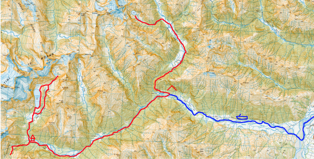
Dec 26 we camped at the Cameron Road end, and met our companion Adrian on Dec 27 at 7:30.  We left our car at the car park, and drove Adrian’s car to Makarora to make our 10:30 jetboat.

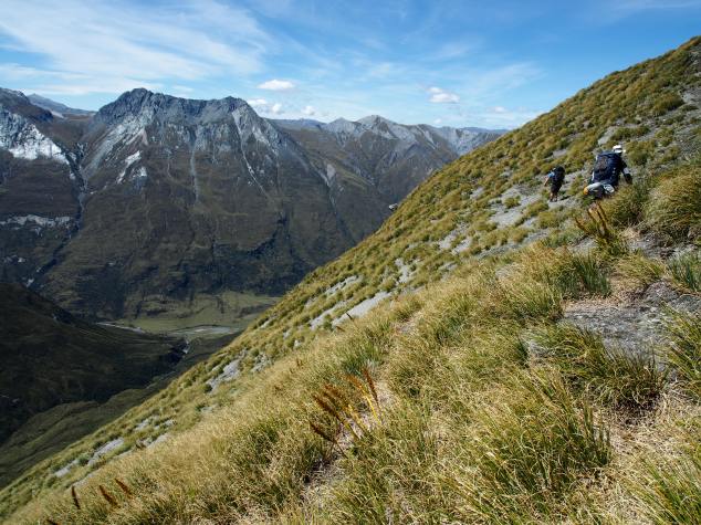
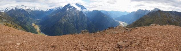
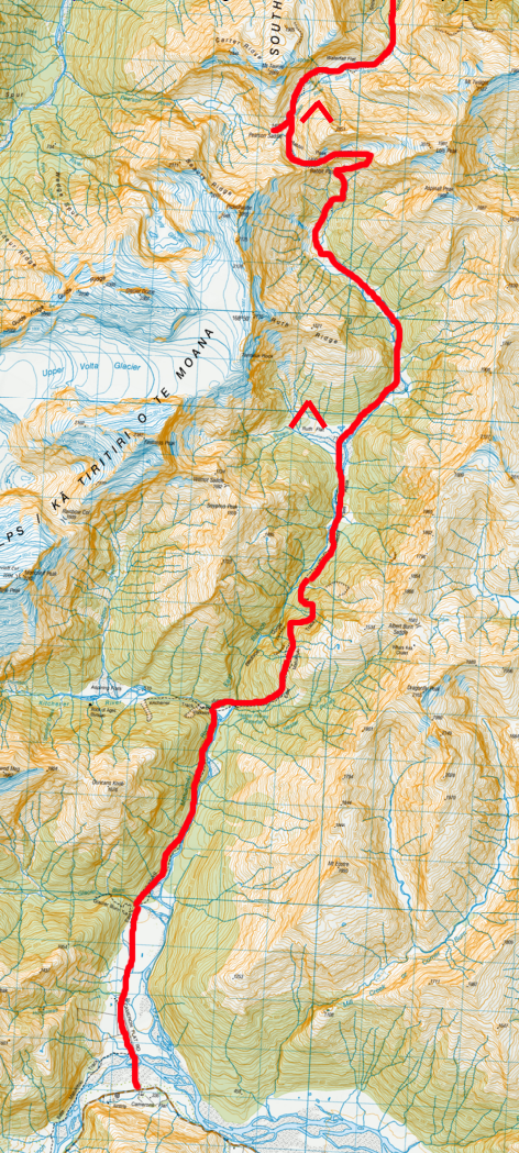
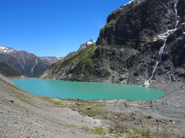
We were dropped off at Kerin Forks on a stunning day.  We dropped our packs and missioned up to Lake Crucible, as Dylan and I had missed the lake when we did the Gillespie Circuit in 2012.  This was as good of an opportunity as any to try and tick it off.

Let’s just say you can do Kerin Forks to Lake Crucible and back in a day, but I don’t know that I’d recommend it.  It took us 10 hours (we think it’s about 28km) without packs.  And it was hot.  But we did it and I can definitely see that it would likely be a highlight of the Gillespie circuit.  All 3 of us were pretty stuffed by the time we had made it back to Kerin Forks.  Too stuffed to try to get over to the hut.  Instead we just camped next to the Wilkin (ohmygod so many sandflies).

12469592_10107067077936100_901915213485410562_o

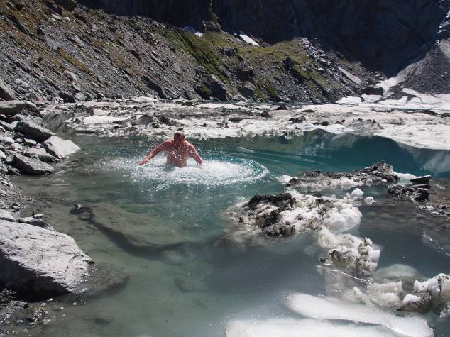
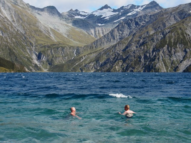
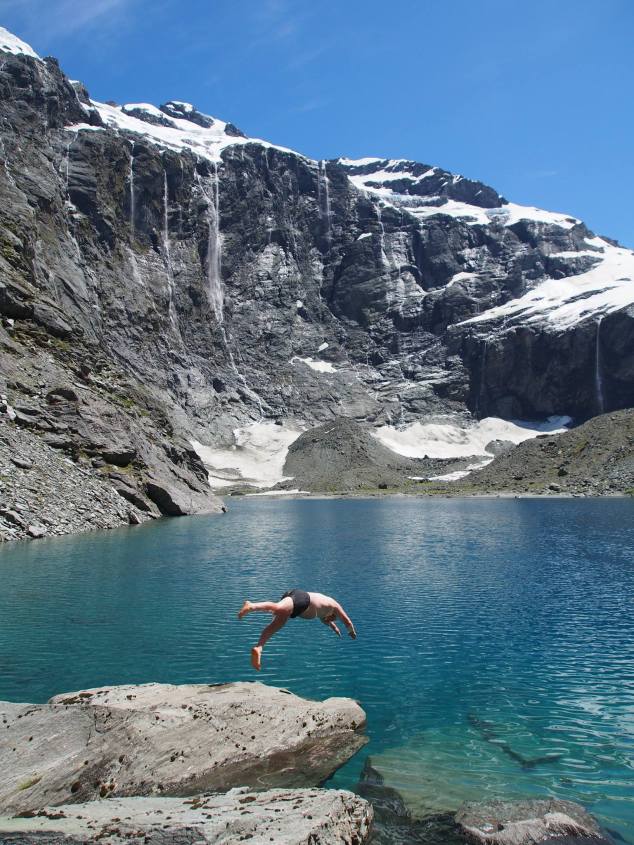
Swimming in Crucible Lake – first equal in our ranking of coldest lakes (tied with the Bryant Glacier terminal lake)

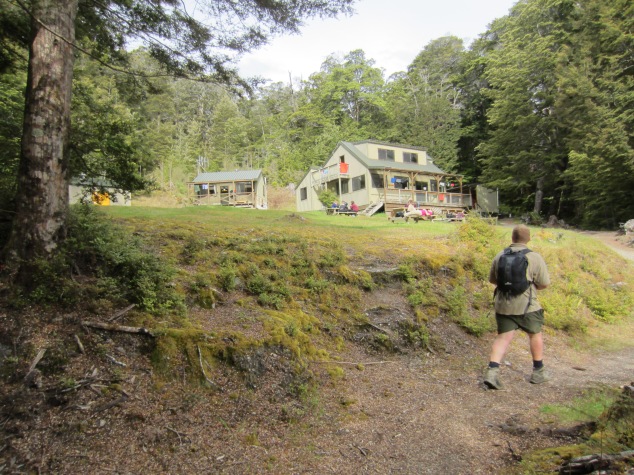
Dec 28 we had a bit of a lie in, and made our way over to the Kerin Forks hut.  On the way, Dylan and I stopped and had a much needed swim as it was clearly going to be another hot day.  Then we were off to top forks hut.  It took us a pretty solid 8 hours to get to top forks hut (from our campsite at Kerin Forks).  That included a much needed stop for a swim (even Adrian jumped in!).

886907_10107067079308350_4404228689537571562_o

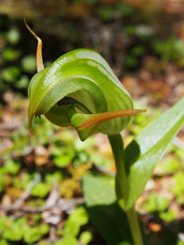
I’m told this is a native Greenwoods Orchid.  Pretty stoked to have spotted this little beauty on the way to top forks hut.

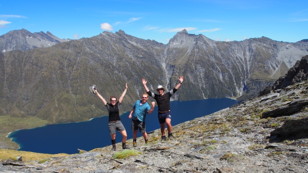
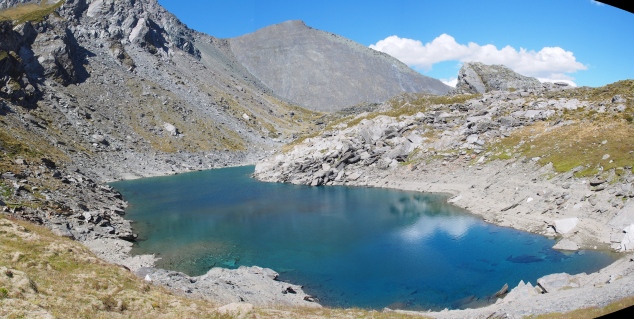
Dec 29 we had another day trip, checking out lakes Diana, Castalia and Lucidus from top forks hut.  This was another spectacular day, and we got away from the hut in good time to get some of the climbing out of the way before the heat of the day set in.  We made it up to Castalia in good time, having a nice long lunch and a much needed couple of swims in the spectacular lake.  Once again, even Adrian had a swim.

12402195_10107067080176610_3249239062971376086_o

Pretty massive avalanche observed on the way to Lake Castalia

12401881_10107067080955050_914408142915357092_o

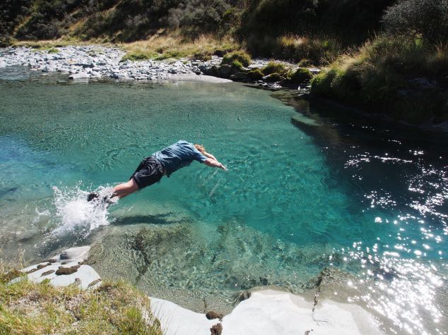
Dylan showing us how you really swim in Lake Castalia

12465973_10107067081738480_3586027231110956797_o

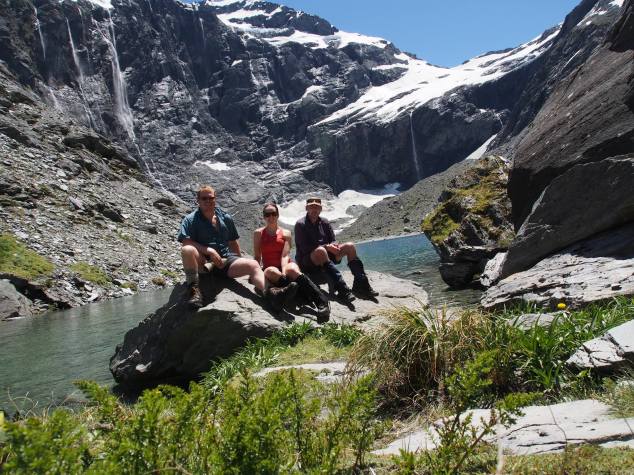
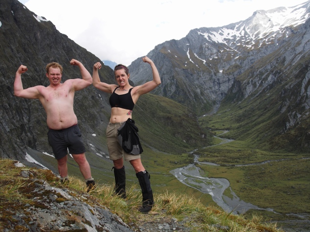
Team photo at Lake Castalia

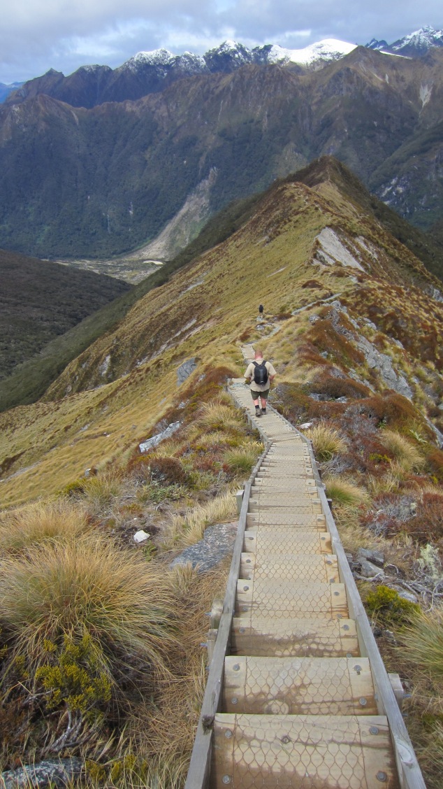
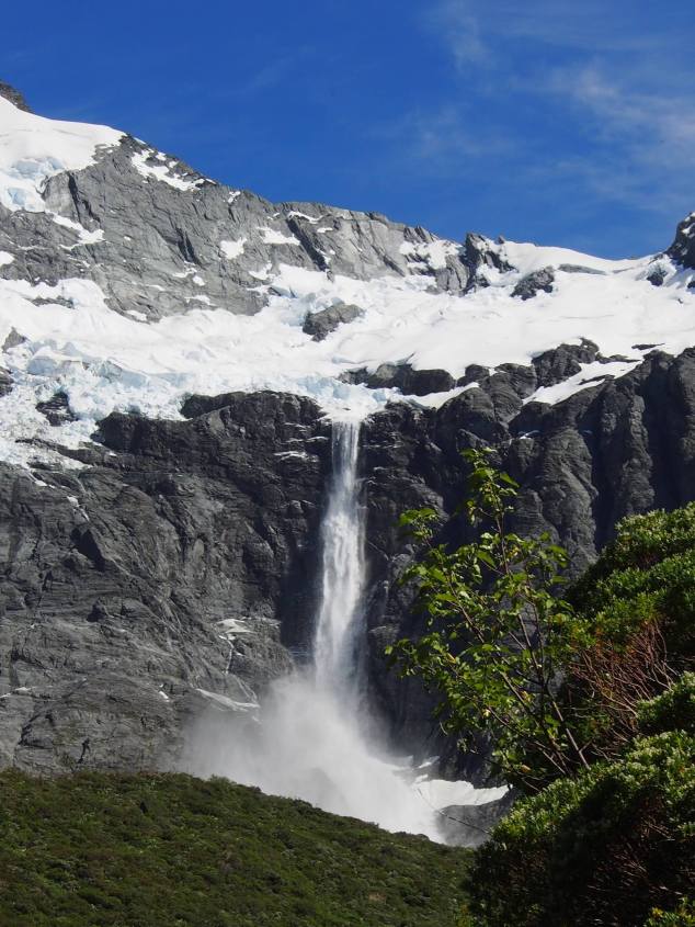
We then wandered over to Lucidus via “the adventurous” route.  We ended up going down some pretty steep and rocky scree (especially near the top) which was reasonably exciting.  Once we made it down, we came across some beautiful flat mossy spots that would be perfect for camping (if one was so inclined) and were rewarded with some up close views of the glacier and a massive avalanche we had witnessed that morning.  We then had a deceptively long (~1 hour) trip boulder hopping around lake Lucidus to the outlet and intersect with the track.  Luckily, it was actually not very steep, and in fact Lucidus has some quite nice beach in spots.

12471493_10107067082072810_7495348585191374131_o

Descending a rocky ridge at the Northeastern corner of Lucidus lake

OLYMPUS DIGITAL CAMERA

I have to admit I found the green colour of Lucidus absolutely stunning

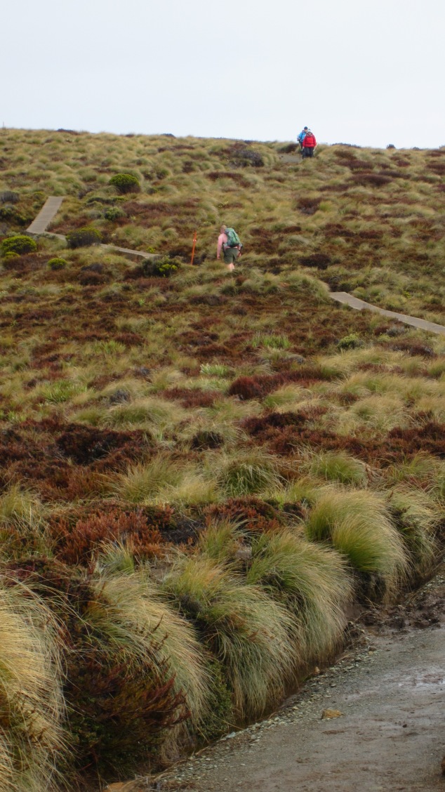
We then headed back down to top forks hut where we had some more swims, chatted with the 8 million people that were staying there/passing through to camp up near lake Diana/stoating etc.  It was later in the evening when 2 blokes who had attempted Rabbit Pass that day returned after an unsuccessful attempt.  They had gotten partway (maybe 1/3) of the way up the waterfall face when one of them became really freaked out and they had to turn back.  Rarely do I remember seeing someone who looked so afraid – and keep in mind this is after at least 3 hours of walking back to the hut.  We assume that they probably went the wrong way, but it certainly put some doubts in our minds.  I have no idea how experienced they were, but they didn’t look like tramping newbies, and they were reasonably solid lads.

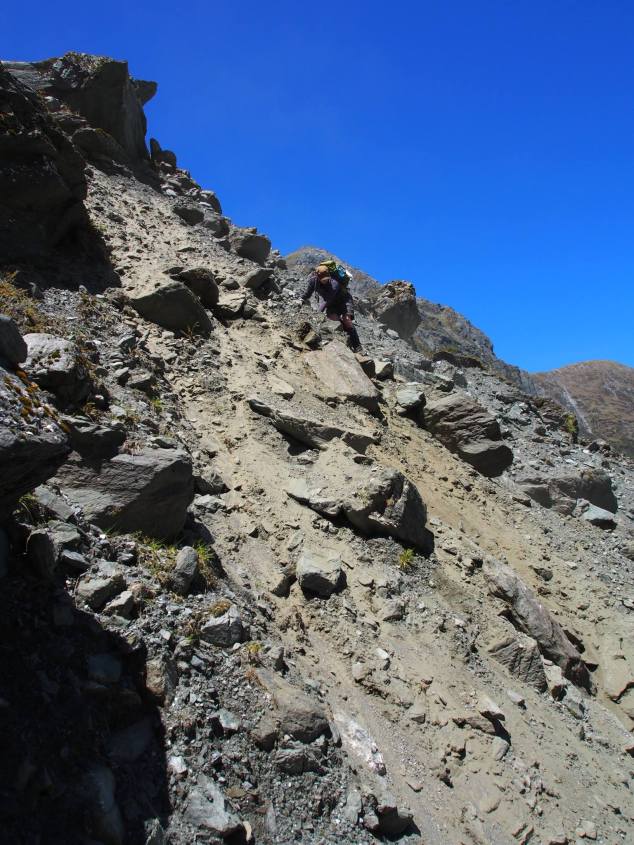
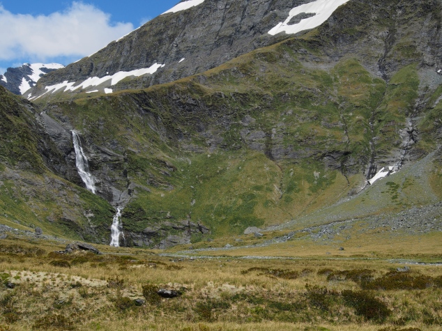
Dec 30 was our “rest” day.  We got another early start and made it to the flats at base of the waterfall face at about 11:30 after a long and reasonably vigorous climb.  Luckily, we were able to observe a guy ahead of us climbing the face as we walked up, and he was conveniently wearing a bright flouro yellow packcover which allowed us to keep easy track of him and the route he took.  He was absolutely motoring up the face and we were impressed at the good time he made.

Meanwhile, we decided to have a very long and leisurely lunch (though truly all of us were a bit nervous so eating was kind of a challenge) while we studied our copy of Moir’s.  We then laid around and procrasta-rested and procrasta-packed our packs and then we finally had to walk up to the face and give it a go.  We had re-packed and adjusted our packs so that they were very tight on our backs (as per the guide we had met at Top Forks Hut’s recommendation).  I had also removed my camera which usually hangs off my front chest strap, and put it inside my pack as I suspected I’d want to keep my chest as close to the rock face as possible.
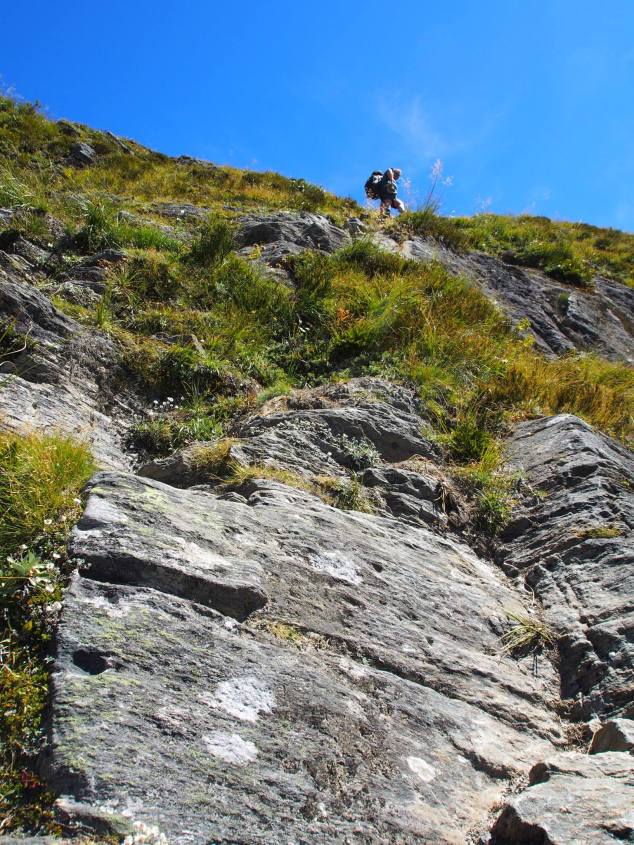
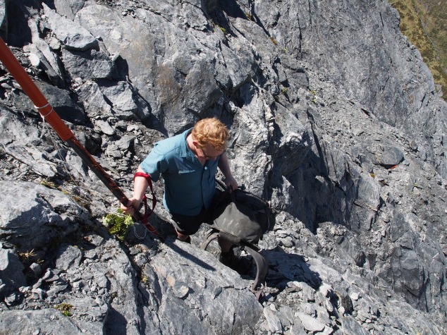
OLYMPUS DIGITAL CAMERA

The Waterfall Face

And then we were off.  To be honest, it was pretty straightforward.  There were more marker poles than we had anticipated (at least 5).  Also, there are a lot of foot marks in the dirt which makes the route pretty clear.  Dylan did a great job being pathfinder though!  I was also very pleasantly surprised that there were at least 3 or so places where we could stop and have a rest and even take packs off, which really helped to break up the climb.  Yes, it was a climb – most of the face is spent hanging on to short bits of grass and scrambling on all fours across rock face.  Yes, the last few metres is just that little bit hairier, but overall we found it to be just fine.  There were no tears.  No moments of panic.  Just concentrated climbing.  And then we were at the top!  Jubilation and group hugs all around (especially as Adrian had attempted the pass some 15 years ago but had to turn back due to poor weather conditions).

I think the reason we found the face straightforward and very achievable was the good weather conditions, more people doing the trip (making the track more obvious), better marking, all of us having a good head for heights, knowing what to expect (consulting Moir’s Guidebook, studying the map and route described), and experience.  Having done things like Waiua pass, Glacier Burn, Brewster Glacier, Mt. Titiroa, Lake Nerine (the three passes), Lake Mavis, Canyon Creek (the unnamed Lake above), and the Otehake meant that we had plenty of experience doing some high, steep, exposed climbing.

PC301965.jpg

Rabbit pass – Dominated!

Once we had recovered from our jubilations of simply arriving at the top, we spent some time taking in the scenery, taking photos and then went along to find a spot to set-up camp.  We pitched our tents, made some hot drinks and soup and had our celebratory octopus lolly (reward lollies are a key incentive for tramping)…  and then it started raining.  And it rained all night.

OLYMPUS DIGITAL CAMERA

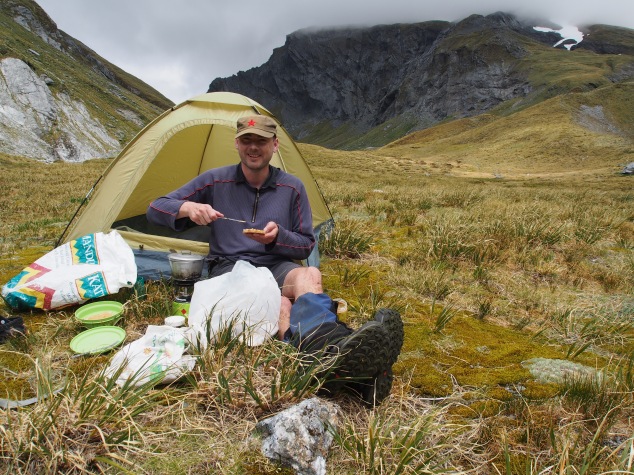
Adrian is going to quit his job, and instead start a new career testing out $17 Warehouse tents in NZ’s most rugged backcountry settings

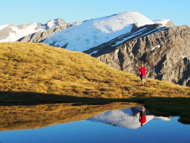
Finally, sometime in the early morning hours on Dec 31, the rain cleared and we were once again greeted with spectacular weather.  We had a reasonably slow start as we spent a bit of time exploring the Pearson Saddle and trying to see the west coast.

We also spent plenty of time taking in the spectacular Rabbit Pass (definitely not just procrastinating the descent, which we suspected would be even hairier than the climb).  It was pretty amazing.

The climb down from Rabbit pass is definitely an order of magnitude scarier than the waterfall face.  Climbing down steep, horrible, rotten, crumbling schist was not fun.  I can’t imagine how anyone who had trouble with the face would handle getting down.  Also, though the route down is clearly marked and we had some rope to lower our packs down, it was still very very tricky.  We spent ages trying to work out how to get across the worst bit – Adrian scouted out the route which eventually ended up being across a scary looking gut, a climb around a bluff, and then some more climbing down towards the next marker pole which appeared to need to be reached by a near impossible route.  Dylan lowered the first pack down (the rope got tangled, of course, and we just ended up throwing our packs off the ledge in the end – not recommended, btw).

OLYMPUS DIGITAL CAMERA

We have to go down there?  (the next orange marker pole is on the right side of the image)

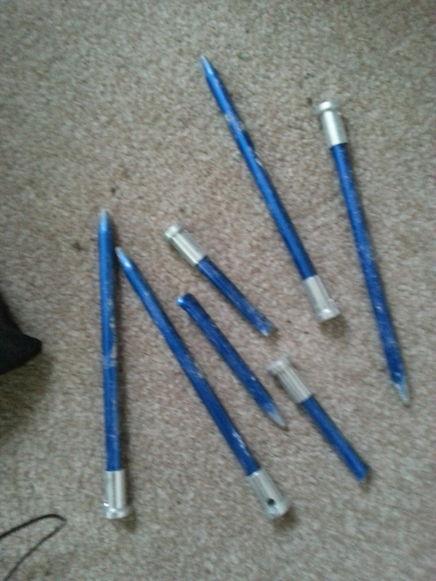
We eventually all made it down, and our packs did too.  We did lose 1 ice axe (mine) and a walking pole (also mine) as they didn’t quite make it far enough and were in a rather unreachable gut.  The ice axe was a bummer, but I was truly lost without my walking pole.  I’m not going to lie, I rely on my pole heavily in uneven terrain, and especially that descent down to the flat.

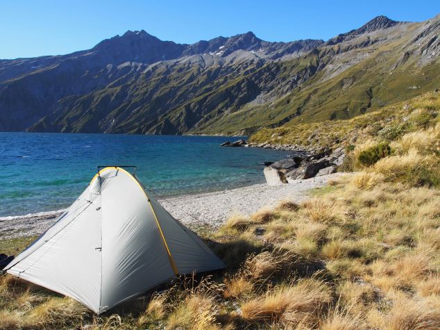
Fortunately as we were making our way down, Matt and Craig (Auckland tramping club members who we met at Top Forks Hut) caught up with us and graciously lent the use of one walking pole (saved me!).  We ended up making camp with them that night at Ruth flat, and they taught us the joys of pics peanut butter sachets (didn’t know this was a thing until then!) and salami that has 200okj of energy per 100g (it’s pretty much a solid log of fat).  These 2 keen trampers/climbers were doing a 9 day link up of the Gillespie and Rabbit Pass.  We all went for a much needed swim at Ruth Flat, and celebrated NYE by running and hiding in our tents at about 8 pm when the sandflies finally became unbearable.  At least I finally achieved my goal of nearly 3 years – to spend NYE tramping (the rationale is that NYE always sucks and never lives up to the hype and so we might as well be tramping because tramping is always fun).

Jan 1 2016 dawned another spectacular stinking hot day.  We parted ways with Matt and Craig early in the morning (as they were much faster than us) as we tackled the bledisloe gorge track.  We reached the 1000m contour line and even though Dylan was keen to head over to the Albert Burn saddle and eventually Dragonfly Peak, Adrian and I had had enough (Adrian’s mat had succumbed to a sharp rock on Dec 30, and I had started thinking about burgers).  I maybe would have been tempted to go check out the Rock of Ages and Turnbull-Thompson Falls, but…  well, we can save those for next time, eh?

OLYMPUS DIGITAL CAMERA

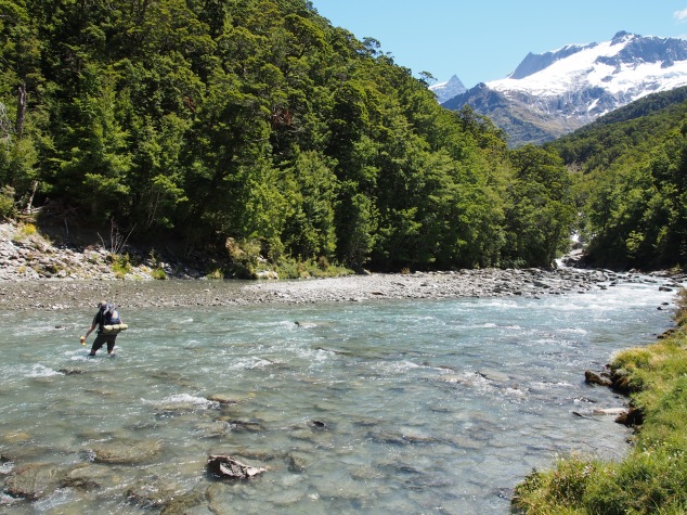
Crossing the Kitchener Creek

In the end, we’d made the right decision.  IT was stinking hot!  We had lunch at Junction Flat next to the Kitchener river, and Dylan had to stop and “wallow” a couple of times to cool off.  About 40 min later, we had a prolonged stop as Dylan dealt with a bleeding nose (it looked like a small animal had been butchered next to the track after we left) – which we attributed it the heat.  It ended up being another 8 hour day and we were very glad we didn’t attempt Dragonfly.  What really saved us (me) was the swim in Homestead Creek next to the carpark at Cameron road.  There is nothing quite like being able to go for a swim at the end of a long, hot tramp.  It meant we actually felt remotely human when we drove into Wanaka looking for burgers at about 7 pm on Jan 1 (Wanaka on New Years Day – never a good idea but somehow it’s always where Dylan and I end up).

We then had to drive Adrian back to his car at Makarora, and then made our way back to Dunedin.  All in all, it was a pretty epic journey, and one that I’m glad to be able to say that I’ve done (considering the notorious reputation).

OLYMPUS DIGITAL CAMERA

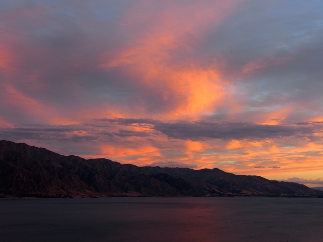
Amazing sunset over Lake Hawea

Did you get up to any exciting trips over the holidays?  If so, please share in the comments below!

Happy tramping!


My holiday tramping gear wish list

If you’re into tramping like we are, you might be a bit of a gearhead.  I think it comes with the territory.  Even though you have all the gear and you don’t really need anything, you’re still always looking for the next bit of equipment that will make your tramp that much more comfortable and enjoyable.  For Dylan, his holy grail is a pair of boots that are not only comfortable, but will last more than a couple of months.

My holy grail is the perfect tent.  I haven’t really done a post about tents – we own two.  Oops.  I think I had intended too, as earlier this year I decided to buy a tarptent double rainbow, after 3 years of hauling my old macpac apollo around at well over 4kg (and getting to the point of leaving it behind and just staying in huts, which admittedly really decreases your flexibility on a trip), and meeting some trampers on the Te Araroa trail who had a tarptent, then reading a million online tent reviews and basically obsessing over getting a new tent for a month or so, I finally caved and bought one – without telling Dylan who I knew would not approve of spending so much money on a new tent.  I was very surprised when, instead of disapproving of my purchase, he just laughed.

We’ve had our tarptent double rainbow tent for 9 months now and have used it in a number of weather scenarios (it really got a workout in the wind on Mt. Titiroa last week).  Yes, it’s definitely lighter than our macpac apollo – it’s less than 2 kg with the groundsheet.  But it’s not perfect.  The original pegs supplied were absolute garbage (seriously, a round, hollow peg?  Yeah, that seems durable) – we threw them out and bought new ones after they just snapped on our second trip.  We also have yet to test out the condensation barrier, even though I paid extra for it.  And the loop at the top of the tent came out of the stitching the second time we ever used it.  Luckily I can sew, and that was a pretty easy fix, but still, quite disappointing in terms of quality.

20150225_080621

Broken pegs – Please excuse the poor quality image

OLYMPUS DIGITAL CAMERA

Broken loop on our second time out!

Our tarptent double rainbow just isn’t as comfortable to sleep in as the macpac apollo.  Even though the tents are very similar in design with two doors and vestibules on either side, it’s got a slightly longer and narrower footprint.  Which I can see the appeal of if you’re a tall skinny couple.  Dylan and I are not a tall skinny couple, and could really use that extra few cm in width.

And finally, with it being a single wall tent with a bathtub floor and mesh all the way around, the wind really has a tendency to blow under tent and through the mesh along the bottom.  Often, it can get a little chilly at night.

So this year, my Christmas wish list is the tarptent rainshadow 2.  It’s the same price as the double rainbow, is lighter (you’ll need both your poles to pitch this one), and has an extra 28 cm in width.  Also, if you ever needed to squeeze another person in, technically it’s a 3 person tent.  Again, I don’t know if it would be the perfect tent (I’d really want to test it in inclement weather – I’m curious if it would hold up without a pole through the middle), I worry that the footprint might be enormous – making it tricky to pitch in alpine tussock (we seem to end up camping up there a lot), so maybe Tarptent Squall 2 would actually be a better fit, as the tent is nearly identical to the rainshadow 2, but even lighter, and a smaller footprint, but still 12 cm wider than the double rainbow.

I’m not only in the market for a new tent.  I’d like a new to me, secondhand pair of meindl boots.  I’ve read too many reviews to ignore anymore the possibility that meindl boots are superior to all others and actually worth the serious cash outlay.  I’m not sure exactly what model I want, I’ve just been keeping an eye on trademe for a good secondhand pair in my size to pop up.

Also, the prongs on our cooker are starting to get really loose.  This concerns me as I really don’t want to lose a meal or burn myself due to a broken cooker prong.

And finally, I’d like to ask Santa to bring Dylan a 60+ litre deuter pack, so he can carry more of my stuff.  He’s getting too fit, and with my latest installation of health/fitness setbacks, I’m really going to struggle to keep up with him this year over Christmas.  Santa should also bring Dylan some new ultrafine merino tops as well.

I really hope Santa shops online.

What’s on your tramping gear wish list this Christmas?

Happy Tramping!


Mt. Titiroa (Oct 24-26, 2015)

Three day weekends are what Dylan and I live for. That extra day means you can do a tramp that has just that little bit extra special something. This past labour weekend, we were lucky enough to finally tick one of the tramps that has been on our list for nearly a year: Mt. Titiroa.

Our local tramping club, OTMC, has had this trip on the cards a couple of times in the last year, but for one reason or another (usually weather) it hadn’t worked out. Despite the weather being a bit ick, there was the perfect window for us to knock out Mt. Titiroa before it really packed it in on Monday afternoon.

In total, there were 10 people on the trip, with 5 in each group starting from each side (Borland Lodge or crossing from Manapouri). We were lucky enough to stay in one of the club member’s family’s bach in Manapouri on Friday night. I must say, I love tramping, but man it is so good to be able to sleep in a bed on the Friday night before setting off.

We were part of the Borland lodge group, so we had about a 1 hour drive until the track start. Overall, it was a pretty uneventful day. Long – we did about 8 hours total, with a big climb and bushbashing at the end. But overall good. We weren’t too rushed, and did the very un-kiwi thing of taking our boots off at our 2 river crossings (the likely fact that we would be in snow the next day, and the fact that we weren’t really in any rush made the extra little effort of keeping our boots dry well worth it).

Rock bivvy in the borland burn

Rock bivvy in the borland burn

We arrived at our campsite at about 1100m near some tarns just as the weather really started to pack in.  Despite the freezing weather, Dylan still decided to have a quick swim (he was already out of the water by the time I actually walked up to the campsite).  The wind and rain picked up, and we all frantically set up our tents and then scurried into them (or maybe that was just me?  I don’t know.  It was cold!). Dylan and I were extremely lazy and cooked inside our tent – which turned out to be a mistake as I melted a hole in one of the mesh inner doors. Oops. 😦 Lesson learned – tie the mesh door back well before cooking under a tent vestibule.

Setting up camp at around 1100m as the weather comes in

Setting up camp at around 1100m as the weather comes in

The night ended up being one of the longest I’ve ever spent in a tent. The wind just howled and the tent shook all night long. Getting up to pee in the middle of the night was not much fun with the wind and rain whipping the tent every which way. But I was very impressed – none of the tents got blown over. I don’t know that is so much a fact that we were all in good tents (MacPac and Tarptent), or just excellent at pitching. Because it was some wind and no one really got more than a handful of hours of sleep. At least we now know that the Tarptent does stand up to high winds as well as the reviews I read claimed!

Lucky for us, the weather cleared in the wee hours of the morning, and we were greeted by a stunning sunny calm Sunday. This was exactly what we had hoped for, as it would be the day we would be crossing over the peak and we wanted the views.

It was a short climb up to 1521 where we realized there was too much snow/slippery rocks for us to stay up high on the ridgeline. Instead, we ended up using our ice axes (we were very glad we had them along) to descend back down about 1300 and travel along the east bowl and climb back up to the tarns at ~1500. For us this was definitely the most sensible route, despite us having to drop down and then climb back up again. We had lunch near the tarns, then headed across more snow up to the ridgeline. We made it to the summit of Mt. Titiroa by about 2:30 or 3 pm and it was absolutely worth it.

Practising our snow skills

Practising our snow skills

View from the top of Mt. Titiroa (1715m)

View from the top of Mt. Titiroa (1715m)

Then we had a very long descent. We decided we wanted to camp on the opposite side of the Garnockburn river – just in case the predicted heavy rain came in early. The descent was really fun – the rock formations on Titiroa are truly spectacular. And we met 2 very curious kea, who were happy to sit for literally hundreds of up-close photos. Myself and the other photographer in the group were pretty stoked to get so up close and personal with a kea. Seeing the keas was another good incentive to camp further down the mountain, as none of us had much sleep the night before, we weren’t too keen to be kept up all night by a pair of keas thrashing our tents and stealing our gear.

Our gorgeous kea friend

Our gorgeous kea friend

We had a good hour or so of bushbashing on this side of the mountain as well, though the bush was much more open and the terrain was easier going. We made it down to the snow white clearing to camp by about 6 pm. We were all shattered after a 10 hour day, but it had been incredibly epic and was absolutely a primo tramping day.

Monday we only had a short walk out to catch the water taxi back to Manapouri. It was an easy track all the way back and we were back at the bach about 2 pm.

All in all it was a choice weekend. And sure, some of the trip members had to forego the rugby to be on the trip, but in the end I think it was worth it. The weather was admittedly exciting on Saturday night, but Sunday was so superb it was worth it, the views and photos we managed to nab were truly stunning, and seeing the 2 keas so up close and personal was definitely a highlight. The trip was easily managed within the 3 days (even with snow) – overall a great alpine trip!

Amazing day

Amazing day

Happy Tramping!

Camp Stream Hut: Sept 12-13 2015

We had 1 full weekend off after our return from Minnesota, and then of course it was back to tramping. Our first tramp (after what has essentially been a 6+ week break) was into the two thumb range, an area which Dylan has been quite keen to get into for some time now, but just hadn’t worked out.

We managed to drag our friend Mark along, who graciously provided us with snowshoes for the weekend.

As usual, we left on Friday after work about 5:30. We stopped for kebabs in Timaru, and decided to camp for the night at Pioneer Park Campground (DOC). It was a very frosty Saturday morning, as it had been raining on Friday night, everything froze – including the car doors. But eventually we were on our way to the Round Hill Ski area. We had hoped to leave our car on their road, but decided against it after we consulted with the Ski area staff. So Mark ended up dropping us off at the point where the Te Araroa trail meets the Roundhill ski area road, and drove around to park and then walk up the Coal River Easement track to Rex Simpson hut and meet up with us later in the afternoon.

Map

Map


OLYMPUS DIGITAL CAMERA

The Te Araroa trail

So our “social” trip started off with just Dylan and I on our own, as per usual. We did enjoy this section of the Te Araroa track immensely, and it was a nice short walk into Camp Stream hut, where we dropped most of our gear and immediately set off to try to meet up with Mark.

We had originally planned to meet up with Mark at Rex Simpson hut, but as we headed around, we instead decided have a quick lunch and meet him on the ridge instead. We did a small loop heading down and crossing Camp Stream, climbing back up to 1641 and then coming back in behind Camp Stream Hut.

This was only the second time I’ve ever been snowshoeing in my life, and I must say I loved it. The fantastic clear blue skies and amazing views over Tekapo probably didn’t hurt either.

Snowshoeing above Lake Tekapo - so epic!

Snowshoeing above Lake Tekapo – so epic!

We got back into Camp Stream hut about an hour or so before dusk and had a lovely evening burning the coal we carried in (though there was plenty of wood at the hut, this is never a guarantee, especially at a hut where trees are absent), taking some night photos, and making custard. Custard is officially our new favourite dessert. I can’t believe we’ve never used it before – it takes up virtually no space, weighs almost nothing and is amazing on any sort of baked good. I expect Custard will feature prominently from now on.

Camp Stream hut is by far the oldest hut I’ve ever stayed in (1898). A word to the wise, if you’re going to stay there in summer, there is no water source. We were lucky there was plenty of snow on the ground, but in a few weeks, you may be out of luck and need to haul water up ~60m from Camp stream below, or 500m down the track.

Proof it's an old hut

Proof it’s an old hut

Camp Stream hut, in all its glorious surroundings

Camp Stream hut, in all its glorious surroundings

Sunday dawned equally spectacular to Saturday, if possibly more breezy. Our goal for the day was to reach Stag Saddle. We headed up the Te Araroa trail and at the point just where we hit the snow, we played musical packs. Loading my pack up with all unnecessary gear for the day, putting my pack on Mark and sending him up the ridgeline. I took Mark’s empty pack and Dylan had his back (with day gear only) and continued up the Valley. Mark eventually met up with us, and I returned his pack to him. We then continued the slog up towards Stag Saddle. As the snow got deeper and the ascent steeper, the going became very very difficult. Even though I felt we had been making excellent time up the valley, Dylan looked at his phone which read 1 pm! We hadn’t even had lunch yet and were still a couple of hours away from Stag Saddle. We realized there was no way it was going to happen, so instead just headed for a point where we could climb back into the ridge.

Walking along the ridgeline

Walking along the ridgeline

At this point I was starving and of course it was much windier on the ridge. So Dylan went along a bit further (up to 1944 and a good view of Beuzenburg peak) which I stopped, put on a lot more clothing, and had some lunch. At this point, Mark caught up with us again after motoring it up to the ridge (having put his skins on his skis) and we came to the conclusion that it was only just 1:30 now – Dylan’s phone had the wrong time and had just been saying “1 pm” all day.

So maybe we could have made it to Stag Saddle, I’m not sure. But by that point we had made the decision to turn around and start the long walk back to the car (another concern of mine – sure we could make it to the saddle, but would I have the energy to cover the nearly 14km back to the car (and keeping in mind we travel ~3km/hour), and make it there at a reasonable time?

As it was, it was nearly dark as we drove past Lake Tekapo for the last time. We stopped for dinner at the Razza Bar in Twizel, and honestly received the most enormous feed I think I’ve ever had after tramping. Each of us got a burger and chips, but these things were absolute monsters (did I take a photo? No, I was too stuffed). Dylan and I could have split a burger and chips between the two of us, and honestly, we can both eat. Especially after tramping. So seriously, if you’re in the Twizel area, I highly suggest Razza for a massive and cheap feed (burgers were about $8-11, chips were an extra $3).

We were very pleased to get out in the snow again this winter. It’s been a very cold and snowy winter here in NZ, so why not make the most of it, right?

Happy Tramping!

The Livingstone Range (6-7 June 2015)

Another late post! Dylan and I wanted to get away on an “easy” trip the first weekend in June. We finally decided to tick off a trip that Dylan had wanted to do for 3 years now – the Livingstone range which is the ridgeline just above the Greenstone track.

We set off from work earlyish on a Friday, and made it to the Divide in good time – around 9:30 or so. We had a very crisp walk into the Lake Howden hut – took roughly an hour. I felt very guilty as we arrived into the hut around 11 pm and disturbed another pair who probably weren’t expecting other trampers to come clomping in so late at night.

Frosty fern at Lake Hawdon Hut

Frosty fern at Lake Hawdon Hut

The night was very cold and frosty. I slept about as poorly as I ever have in a hut as it was absolutely freezing. I’m not sure how it’s possible, but I’m certain Howden hut was colder inside than outside. Honestly, even Dylan was cold. It was like sleeping in a fridge.

But we had a decent start and headed back up to Key Summit and had easy travel along the tops – there is a route most of the way. We were rewarded with many spectacular views.

Reflections

Reflections

Frozen tarns

Frozen tarns

As the day progressed, the wind started to pick up and clouds started to come in – it was getting cold and I was getting tired. After some discussion, we decided to head down towards McKellar hut earlier than planned (our original plan was to hit 1543 then come down the ridge as we anticipated there might be a bit of a track there). Instead, we ended up going down a very steep face and then bush bashing for ages. I’m not sure when the last time you tried to bushbash your way through fiordland forest but I do not recommend it. I had no idea that ferns felt so much like razors on bare skin (sure it’s winter but this is NZ so who wears pants, am I right?)!

Descending back down towards McKellar Hut

Descending back down towards McKellar Hut

Bush-bashing

Bush-bashing

After a couple of hours struggling to make our way down, we finally made it back to the Greenstone track. We were very glad to see signs of civilization again. So much for an “easy” day!

Nothing quite like signs of civilization!

Nothing quite like signs of civilization!

That night we had McKellar all to ourselves (some hunters were holed up in the warden’s quarters, however) and managed to get it nice and toasty. And being the good trampers we are, we left it stocked with more wood than was there when we arrived (as many previous trampers complained about the lack of dry wood upon arrival at the hut). I hope whoever arrived after us did the good thing and continued to replenish the hut wood supply.

Re-stocking the wood in the hut

Re-stocking the wood in the hut

Paying it forward... leaving heaps of wood for future trampers

Paying it forward… leaving heaps of wood for future trampers

Sunday was a super easy day after our wood making session. And as a bonus, we came across this little guy – a species of fungus I had never seen before – for which I was incredibly thrilled.

Hotlips Puffball - Calostoma rodwayi

Hotlips Puffball – Calostoma rodwayi

Have you been able to get out on many trips this winter? Happy Tramping!

Don’t tramp when you’re sick – Lagoon Saddle Day walk ( July 4 2015)

I’m really sorry it’s been so quiet around here lately.  This winter has been plagued with sickness. And when I say this winter, I mean me. I’ve been plagued with sickness after sickness this year. I’ve managed to pick up 2 different colds and Dylan and I were both struck down with a wonderful vomiting bug. Which brings us to the first tramp we tried to do in July.  [Then August we were overseas on holiday so…  we’ve fallen behind on our posts!]

We decided to head out again a full week after I’d had the vomiting bug, and I was actually feeling pretty good. So we collected some friends and headed up to Arthur’s Pass to finally try and knock off the Cass/Lagoon track, one which has been on our list for a couple of years. We were all kitted out with our crampons and ice axes, we hadn’t forgotten any food, we left work early on Friday night so got up to Bealy hut at a very reasonable time on Friday night.

Bealy hut

Bealy hut

But Saturday morning, I woke up with a cold. And the other girl in the group (who had also recently had the same wonderful vomiting bug) was feeling ill/nauseous as well. The morning did not go well. I felt, really really terrible. Climbing is about the last thing you want to do when you feel sick. The more we walked, the more exhausted and terrible I felt. Furthermore, we weren’t even close to making track time. It was… unpleasant.

We finally got to the lagoon saddle, and decided to go as far as the Lagoon saddle shelter for lunch and reassess. Unfortunately, the lagoon saddle shelter is really basic. We had to decide if we should carry on to the next hut, stay at the (basic) shelter, or go back to Bealy hut. We ended up making the call to go back to Bealy hut, as I was worried I would feel worse on Sunday – in which would be terrible if we had more walking to do.

So that was a major bummer. I actually felt a bit better after lunch – whether it was panadol, food or simply water that made me perk up, I’m unsure. Regardless, I was still sick on Sunday, so in the end we definitely made the right call.

It was a major bummer to drive all that way and only do a day walk (with full packs, no less)! No one was really up to doing a 2nd day walk on Sunday.  However I did manage to score this photo on the way home.  Score?

Sheep near Arthur's Pass

Sheep near Arthur’s Pass

Happy tramping and stay healthy!